


介绍 India Satellite Weather
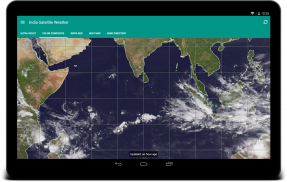
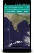
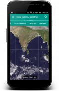
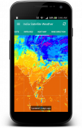
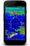
"A picture is worth a thousand words". A complex weather data can be conveyed easily with an image map. By observing the Cloud formations around your City, you can easily predict whether the day is going to be Hot or Rainy/Cloudy.
It is very well equipped with data caching capabilities and will never download duplicate data from the server. The downloaded weather maps will stored locally and can accessed offline.
This application fetches the weather maps directly from Indian Meteorological Department (www.imd.gov.in) and CIMSS [USA] (http://cimss.ssec.wisc.edu)
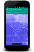
FYI: I really don't have control on the missing north indian region of some map types because they are provided by USA Meteorological Department.
This is an Open Source Application: https://github.com/Shahul3D/IndiaSatelliteWeather
Feel free to contribute!
“一张图片胜过千言万语”。一个复杂的气象数据可以很容易地与影像地图来传达。通过观察周围的城市云编队,你可以很容易地预测是否一天将是热还是雨天/阴天。
这是很好的配备了数据缓存能力和永远不会从服务器上下载重复的数据。下载的天气地图将本地存储,可以访问脱机。
该应用获取天气直接从印度气象局(www.imd.gov.in)和CIMSS [美国]映射(http://cimss.ssec.wisc.edu)
FYI:我真的不因为它们是由美国气象部门提供的有一些地图类型的缺失北印度地区的控制权。
这是一个开源应用程序:https://github.com/Shahul3D/IndiaSatelliteWeather
随意贡献!
India Satellite Weather - 版本5.0.6
(27-01-2020)
India Satellite Weather - APK信息
APK版本: 5.0.6程序包: com.shahul3d.indiasatelliteweather同类应用
您可能还会喜欢……


